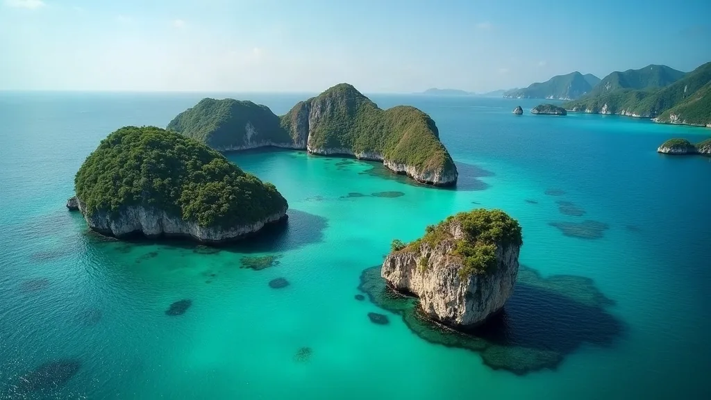
The Wayag and Kawe area at the northwest end of Raja Ampat is a long, unsupported leg through a landscape that has no equivalent anywhere — and it demands full self-sufficiency, a real weather window, careful anchoring among steep-to karst, and permission where access is controlled. Treat it as an expedition run from a fully stored vessel, not as a day trip from the Dampier Strait.
The geography that makes it worth the run
The northern islands are the image most people carry of Raja Ampat: clusters of mushroom-shaped limestone islets rising from clear lagoons, viewpoints that require a climb over sharp karst, and water that is unusually clear because there is very little land run-off.
They are also a long way from anything. There is no settlement of consequence, no fuel, no water, no technical help and no realistic evacuation path that does not begin with several hours of steaming back the way you came. That combination — extraordinary and unsupported — defines how the leg should be planned.
Range and stores
The arithmetic is the same as for the southern run but in the opposite direction: passage up, repositioning while there, passage back, plus a genuine weather-delay reserve, plus an untouchable margin. Water comes from the watermaker. Provisions come from what you loaded at Waisai and Sorong. Spares come from the locker, because nothing is arriving.
Two things are worth over-carrying specifically for this leg. Fresh water, because guests use more than planned in heat and after climbing. And tender fuel, because almost everything here is done by tender and the distances between anchorage and objective are larger than they look.
Anchoring among the karst
The bathymetry in the northern lagoons is the archipelago’s steep-to character at its most extreme: deep water, a narrow shelf, and coral formations rising abruptly. Sand patches exist and are often small.
The technique is the one described in detail for Raja Ampat anchorages generally — high sun, lookout up high, visual identification, drop on the sand, back down, verify the swing in both stream directions — but applied with less margin for error and with no nearby vessel to help if it goes wrong. If a lagoon does not offer a patch big enough to swing in, do not improvise; there is usually another one.
Where the swing genuinely cannot be made clear, some crews consider a line ashore. In this landscape the shore is sharp, brittle limestone and the vegetation is fragile — the constraints are covered in detail in the piece on stern lines in karst bays, and the short version is that it is rarely the right answer here.
Access and permission
Parts of the northern area are subject to access management: entry to some locations and viewpoints is controlled, guides or local escorts are expected in places, and the surrounding waters are inside the protected area network with its own restrictions. Customary rights apply to reefs and shores here as they do everywhere in the regency.
Arrange this before you go rather than on arrival. A vessel that appears in a controlled area and starts landing guests without having spoken to anyone creates exactly the friction that makes life harder for every yacht that follows. The entry and clearance page covers the framework and the landings page covers the etiquette.
Timing the window
North-facing coasts take the weather during the northwest monsoon period, broadly December through March, which is exactly when the southern run to Misool is at its most comfortable. During the southeast period the northern islands are generally the more sheltered choice.
The transitional months give the best chance at both, which is why programmes of two weeks or more scheduled in those months are the ones that come home having done everything. Vessels with less time should pick a zone rather than attempt both — the cruising guide sets out how that decision is made.
The shore excursions
The viewpoints that produce the photographs involve climbing sharp, undercut limestone, often in heat, sometimes on ropes fixed by others of unknown age. This is a genuine injury risk and it is the most likely cause of a medical incident on the leg.
Brief it honestly with guests before the tender leaves: footwear with grip and ankle support, gloves, water, and an honest self-assessment of fitness. Carry a proper first aid kit in the tender, not the small one. And remember that a broken ankle in the northern islands is several hours from Waisai and a further ferry or flight from real medical care — the constraint described on the facilities page.
Leaving it as you found it
The northern islands are heavily photographed and lightly visited, and their condition depends on that ratio holding. Take nothing, leave nothing, keep tenders slow and off the coral, do not touch or stand on reef, and hold all waste aboard for the mainland.
The people who manage and live around these islands have made real sacrifices to keep them intact. A visiting yacht’s entire contribution is to behave well and pay the park contribution honestly. It is not a heavy obligation for what you get in return.
The medical and communications picture
This is the leg where an injury or an illness is most consequential, and it deserves an explicit plan rather than an assumption. The recovery path from the northern islands begins with several hours of steaming, continues with a ferry or a charter across to Sorong, and only then reaches an airport. Nothing about that sequence is fast.
The practical response is a proper offshore medical kit rather than a coastal one, at least one crew member with real first-aid training, telemedicine access over satellite, and a genuine emergency beacon carried and understood. Brief the guests honestly before the leg: this is remote, help is hours away, and personal medication should be carried in sufficient quantity because there is no pharmacy. The wider preparation logic is in spares, failures and isolation.
Timing within the day
Arrive with the sun high. The lagoons here are steep-to with small sand patches, and the anchoring technique described in spotting a sand patch depends entirely on light. A late arrival into an unfamiliar northern lagoon is the classic way for an otherwise well-planned expedition leg to go wrong in the last twenty minutes. Plan the passage so that you arrive in the middle of the day, or stand off and enter in the morning.
Frequently asked questions
Do you need a permit to visit Wayag?
Access to parts of the northern Raja Ampat area is managed, with controlled entry at some locations and local guides or escorts expected in places, on top of the marine park entry contribution that applies throughout the regency. Arrange access in advance rather than on arrival.
How far is Wayag from Waisai?
It is a long leg to the northwest, several hours of steaming, through an area with no fuel, water, technical support or realistic evacuation path. It should be planned as a self-sufficient expedition run with a weather window and a full reserve.
Talk to the berthing desk
Raja Ampat rewards vessels that arrive with a plan. Share your LOA, draft, arrival window and intended islands, and we will answer with what is realistically available. Quotations in USD.